Santa Vittoria
map of Santa Vittoria with the marked points of interest
 The Santa Vittoria complex is situated in a splendid location on the Giara di Serri plateau. The site spans an area of approximately 3 hectares.
In total, the remains of over 50 buildings from the Nuragic era still stand here. Their construction is dated from the 13th to the 8th century BC.
The structures are divided into various sections associated with the sacred well and interpreted as residential or assembly buildings.
At the info center, you can obtain an overview map of the extensive area with German labels. However, navigating the terrain with this map is somewhat difficult because the arrangement of the individual sections and the distances between them are depicted inaccurately.
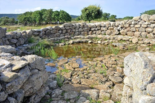
 The most significant structure of the complex is the well temple with the sacred spring.
The well shaft is about three meters deep and lined with carefully hewn basalt blocks. Originally, it was probably covered with a dome, of which only small traces remain.
A staircase leads down from the antechamber to the spring. On the side walls of the small antechamber are stone benches, which were apparently used for religious rites or as a place for votive offerings.
In the middle of the antechamber, a small collection basin is embedded in the floor, with a channel leading obliquely outward. This was likely used for sacrifices, and the channel prevented the spring from being contaminated with the blood of sacrificed animals.
 The well temple and the associated buildings stand on a rocky outcrop at the edge of the Giara di Serri.
Already in Byzantine times, there was a small church here, on the remains of which the present church was built in the 11th-12th century. This church is dedicated to Maria della Vittoria and gave the surrounding complex its current name.
In the vicinity of the church, excavations have uncovered items suggesting that a Byzantine garrison was stationed here in the 6th and 7th centuries.
Next to the church is a viewpoint from which there is a fantastic view over the plain below. In the valley below, you can see the town of Gergei (photo) and further to the right, the Giari di Gesturi.
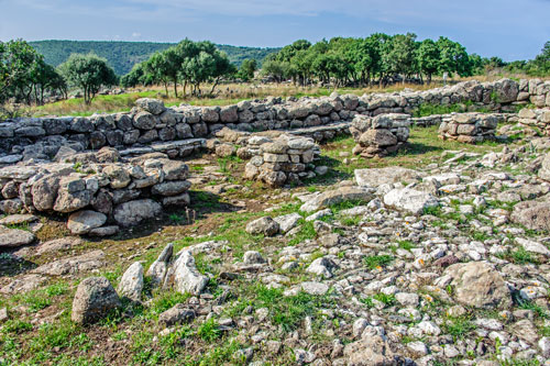
 Just a few meters from the well is the so-called festival square.
The entire square is surrounded by an elliptical wall (about 75 x 50 m) and was probably completely paved originally.
Several buildings are integrated into the wall, designated as a “foundry,” “assembly house,” or “kitchen.”
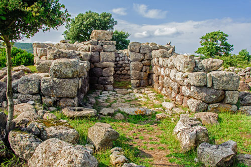
To the north of the square are the remains of individual cells with stone benches (photo).
Additionally, there are remnants of a series of rectangular pillars along the inner side of the outer wall. These pillars likely supported a wooden roof, forming modest shelter for pilgrims.
 The entire Santa Vittoria complex was examined in the early 20th century under the direction of archaeologist Antonio Tamarelli. Tamarelli suspected that religious festivals and sporting competitions were held here.
His work was continued by various researchers, who proposed different hypotheses about the excavations.
Because the Nuragic people left no written records, interpretations are often quite speculative.

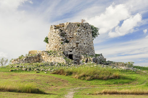
North of the “festival square” stands a single building referred to on the corresponding information board as “Tempio in antis” (photo).
Tamarelli definitively did not see this as a temple but as the dwelling of a leader (Capanna del Capo).
At the info center at the entrance, I was told that the Nuragic people worshiped the moon here…
Despite the various interpretations and sometimes confusing information on the boards, a visit to the site is very impressive and provides insight into the great architectural achievements of the Nuragic people.
Isili
 From Santa Vittoria, you can make a detour to Isili.
The very lively community offers all amenities, and the beautiful surroundings have numerous prehistoric sights. In summer, Isili is served by the Trenino Verde. The area is also popular with climbers.
The best-known attraction is the Nuraghe Is Paras (photo). It stands on the northern outskirts and is considered one of the most beautiful nuraghes in Sardinia. Unlike the typically dark nuraghes, white limestone was used here as the building material.
If you continue north from here, you will drive over the Is Barrocus reservoir. On a cliff in the middle of the lake stands the small church of San Sebastiano.
Church of San Sebastiano
 North of Isili, the SS128 crosses the Lago is Barrocus reservoir on a bridge.
In the middle of the lake is a large cliff on which the Church of San Sebastiano stands.
The exact date of the church’s construction is unknown, but documents show that it was used as a place of worship at the end of the 16th century.
Following a tragedy during a wedding, in which several people fell from the cliff, the church fell into disrepair.
With the construction of the Is Barrocus dam from 1985 to 1991, the cliff became an island and can now only be reached by boat.
The church has since been restored to its original form but is not used for religious services.
