Burgos and surroundings
map of Burgos and surroundings with the marked sights
Burgos
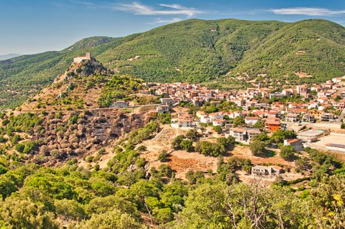
The municipality nestles picturesquely against a mountainside, atop which stands the ruins of the “Castello di Goceano.”
If you arrive here by car, it’s best to leave your vehicle at one of the squares in the center and explore the area on foot. While it’s theoretically possible to drive up to the castle, the roads are very steep and narrow.
On the way to the castle, you’ll pass by the “Museo dei Castelli di Sardegna.” Here, you can gain an overview of the various fortifications across the entire island. Unfortunately, the museum was closed during our visit.
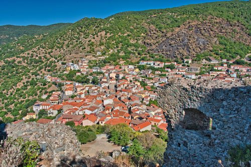
Nuraghe Erismanzanu

In the vicinity of Burgos, there are several Nuraghe, although they are often difficult to find or inaccessible.
Erismanzanu dates back to the Middle Bronze Age, approximately from the 16th to the 13th century BC.
It is a type of Tholos Nuraghe with a tower built from trachyte blocks. These blocks were precisely shaped to fit together without significant gaps or mortar. They gradually decrease in size towards the top, forming an almost perfect outer wall.
The Nuraghe still stands about 8 meters tall, with some trees growing on top, giving it the appearance of an oversized flowerpot.
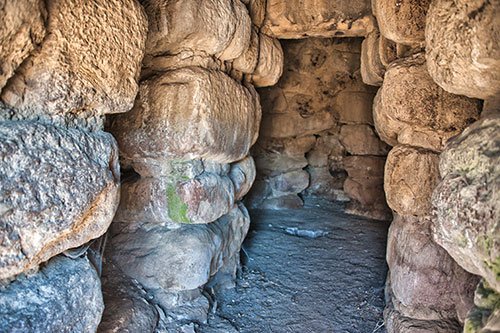
Behind the entrance, there is a niche on the right, and on the left, a staircase leads upwards. You can ascend here, but it’s advisable to bring a flashlight. At the top, amidst the vegetation, you can still discern two storage chambers that were built into the ground.
In the main chamber of the Nuraghe, there are three niches in the walls and a roughly 1-meter-deep pit, presumably used as a food storage depot.
How to get there: There is a signposted exit on the SP101 at around km 6. It’s best to leave your car here.
A bit further, next to a gate, there is a second (faded) sign. From here, it’s about 600 meters to a farmhouse on whose property the Nuraghe stands. (see map) You will be loudly announced by guard dogs upon arrival. The owners are very friendly and welcoming to tourists.
We also had to search for a while here because we initially missed the second sign.
The area consists of fenced pastureland used for goats and sheep. Please respect fences and closed gates, as the small herds are guarded by sometimes aggressive dogs.
Hike at Monte Rasu
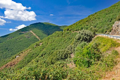 The mountains north of Burgos are covered with beautiful forests, offering numerous hiking trails.
One of the most interesting routes initially circles around Monte Rasu and eventually ascends to its summit.
With an elevation of 1259 meters, Monte Rasu is the highest peak in the province of Sassari, easily recognizable from afar by its antennas on the summit.
The surrounding forests escaped rigorous deforestation and were protected as early as 1886 by a royal decree.
They are among the most beautiful forests in all of Sardinia, primarily consisting of holm oaks, with downy oaks, cork oaks, French maples, and holly trees found in the lower elevations.
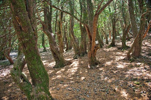
A unique feature of Monte Rasu is the “Ghost Forest” Sos Nibberos, where thousand-year-old yew trees stand – the oldest yews in all of Sardinia.
The bizarrely shaped trees are covered with lichens and moss, giving the area a gloomy and eerie character.
Due to its uniqueness, this forest was declared a natural monument in 1994.
The easy hike follows wide, mostly shaded forest paths, with no significant changes in elevation except for the detour to the summit.
Sturdy, lightweight shoes are sufficient for this hike.
Along the way, there are numerous scenic viewpoints, especially from the summit where you can see far into the plains.
The circular route takes about 3 hours, with an additional hour needed for the summit climb including a break.
There are no dining options along the trail.
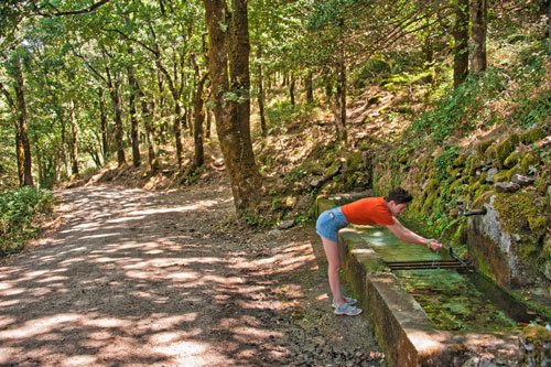
At the beginning, you’ll pass by several springs where you can refill your water supply. However, there are no more water sources after the “Ghost Forest,” so be sure to bring enough water with you.
How to get there and route description: For the hike, it’s best to park at the parking lot next to SP6 at the Ucc’Aidu pass summit.
The road to Monte Rasu is well signposted in Bono. If you’re coming from the other direction, simply drive to the highest point of SP6. (see map)
From the parking lot, head straight uphill for a few hundred meters (passing a few junctions).
Don’t turn left at the signpost for “Monte Rasu” as this is where the loop connects on the return.
The tour follows a gentle up-and-down path around the mountain counterclockwise. Towards the end of the loop, you’ll come across a track that leads left to the summit.
The hiking trail was marked with red and white markings years ago, but they may be sporadic now. You can download a free GPS track of the tour for your navigation device or app.
