Costa Rei and hinterland
map of the Costa Rei and hinterland with the marked sights
Costa Rei

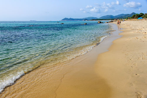
The “Royal Coast” is one of the most beautiful beaches in Sardinia.
Stretching for 10 km, it boasts the finest white sand, gently sloping into the crystal-clear sea, which dazzles in various shades of blue.
Inland, holiday home settlements have emerged, although they remain modest considering the entire length of the beach.
During the pre- and post-season, it’s relatively peaceful here, with only a few families from Cagliari visiting on weekends. Even in the peak season, the beach isn’t overcrowded—its sheer length prevents that.
However, supermarkets and restaurants may not always be open outside the main season, so having your own vehicle is essential during these times.

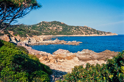
In the north, the rocky coast at Capo Ferrato marks the boundary of Costa Rei.
A trip here is worthwhile, as the summer tourist crowds are far less than those on the sandy beaches further south.
The landscape in this area is quite diverse, and the small coves are excellent for snorkeling.
Heading north, there are some dirt tracks where you can embark on short hikes.
At the easternmost point stands a lighthouse.
Towards Villasimius

Villasimius is the most significant town in the vicinity of Costa Rei.
With the onset of tourism in Sardinia, the village has experienced tremendous growth and benefits from the beautiful coastal stretches in the surrounding area.
In the town center, you’ll find excellent restaurants as well as options for self-catering.
If you’re driving from Costa Rei to Villasimius, the inland road is the quickest route.
However, much more interesting is the fantastic coastal road, which winds its way above the sea in numerous curves.
Magnificent vistas open up repeatedly along the route. Nestled into the mostly rocky coastline are several small, dreamy sandy coves.
Fortezza Vecchia

A bit south of the port of Villasimius, perched on a protruding rock, stands a former fortress. You’ll pass by it on your way to Capo Carbonara.
The initial fortification was established here when the Spaniards conquered the island in the 14th century.
By the 16th century, pirate raids along the coasts of Sardinia became increasingly common, leading to the reinforcement of existing fortifications and the construction of new watchtowers around the island. (The approximately 70 Saracen towers along the coasts also date from this period.)
During this time, the fortress took on its current appearance, and some minor renovations and modernizations were carried out around 1770.
The last garrison was withdrawn in 1847. The fortress lost its military significance and gradually fell into disrepair until it was restored from 1968 to 1973 and again in 1987.
The site is open to visitors, and inside, you can see numerous documents from the era of pirate raids and two cannons.
Capo Carbonara

South of Villasimius, a long peninsula extends into the sea, with Capo Carbonara located at its southernmost point.
Although the cape and its lighthouse belong to a military restricted area, which you are not allowed to enter, the surrounding area is still worth a visit due to its stunning landscape.
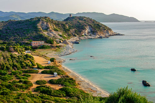
By the water, there is also a beautiful beach that stretches for about 1 km, overseen by a Spanish Saracen tower.
Gola di Cannas
 South of Muravera, the old SS 125 deviates from the coast and winds its way through the mountains towards Cagliari.
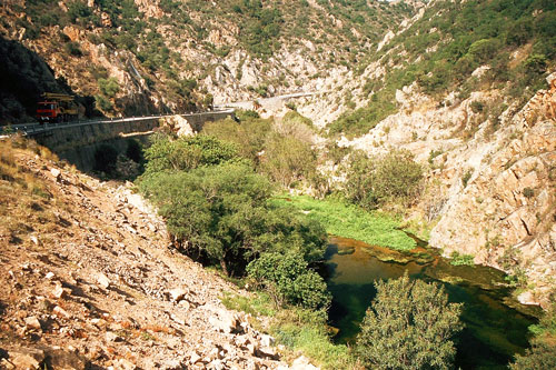
Along much of the route, it passes through beautiful gorges, such as here at the Riu di Cannas.
Especially in the spring, the river carries a relatively large amount of water.
Therefore, it’s worth parking the car at one of the viewpoints and taking a walk along the river below.
Numerous cool pools invite you to swim.
Monti Sette Fratelli
 In this mountainous region, a beautiful nature park was established – the Parco Sette Fratelli.
The “Seven Brothers” are prominent rock spires that gave the mountain its name.
At the entrance of the park, there is a visitor center that provides information about the flora and fauna of the region.
The park features well-maintained hiking trails and forest roads, some of which visitors are allowed to drive through by car.
