Points of interest north of Alghero
map with the points of interest north of Alghero
Nuraghe Palmavera
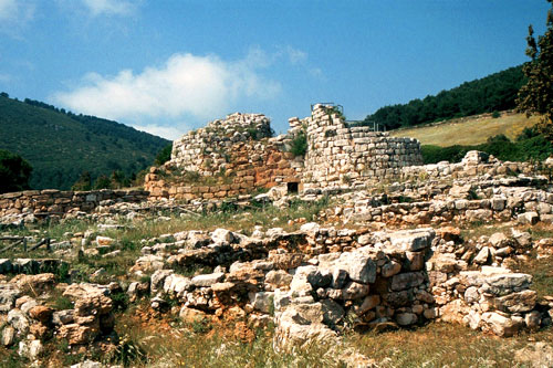
The Nuraghe village is located directly on the SS 127, west of Fertilia. The site is quite impressive overall, especially the two towers built from massive stone blocks. Around them are the foundations of about 50 houses belonging to the Nuraghe village. The main tower can be climbed, offering a good view of the entire site from the top.
If you also want to visit the nearby necropolis “Anghelu Ruju,” you can purchase a discounted combined ticket for both sites here.
Necropolis Anghelu Ruju
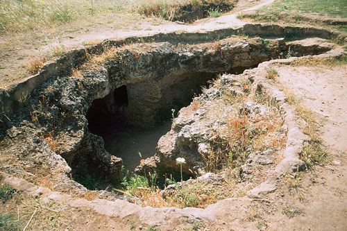
The necropolis is located north of Alghero and is well signposted. A total of 38 burial chambers—called “Domus de Janas” (Fairy Houses)—were carved into the rock. The burial site dates back to around 300 BC and was only discovered in 1904.
If you want to examine the individual chambers more closely, a strong flashlight is recommended. Additionally, during the hot summer, it is better to visit early in the morning or in the evening when the sun is not as intense.
As in Palmavera, there is also a combined ticket available for both attractions.
Monte Baranta

Monte Baranta is a pre-Nuragic mountain fortress from the Copper Age (circa 2500-2200 BC). The site was first mentioned in 1962 and excavated in the late 1970s. Well-preserved remains include an arched wall with two entrances (photo) and an almost 100-meter-long wall that is up to 2.5 meters high and 5 meters thick. On the plateau, there are also remains of the foundations of residential huts and some menhirs lying on the ground.
How to get there: About 1 km south of Olmedo, a road branches east from the SP19. During my visit, it was marked as a private road and could not be driven on. The road leads about 1.5 km up the mountain. Before the waterworks, keep right and then immediately left to the entrance gate. From there, it is a 10-minute walk on a narrow path. (see map)
Necropolis Santu Pedru
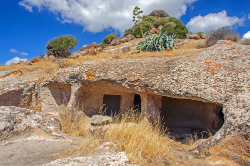
The complex of rock tombs (domus de janas) was discovered in 1959 and fully excavated by 1994. Numerous ceramics were found here, indicating long-term use from the Neolithic to the Middle Ages. The largest grave is locked with a grate and can only be visited by prior appointment. However, there are several other graves above it that can be freely visited.
How to get there: From the roundabout between Olmedo and Surigheddu, take the SS127 towards Uri/Ittiri. After about 2 km, turn left onto a narrow side road. (see map) During my visit, there was no signage at all.
Fertilia
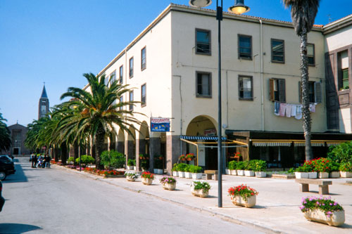 The town was created in the 1930s during Mussolini’s dictatorship.
Farmers from northern Italy were brought in to cultivate the swampy surroundings.
Fertilia was thus part of the agricultural projects aimed at bringing Sardinia into the modern era.
The center is dominated by typical Fascist architecture with its drab block construction.
Ponte Romano
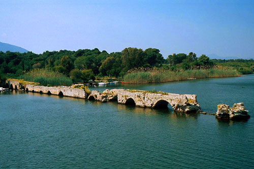 Directly east of Fertilia are the remains of an ancient Roman bridge in the Stagno di Calich.
The bridge was part of the road connecting the Roman settlement in Bosa to Turris Lybissonis (Porto Torres).
It was used for centuries and restored in the Middle Ages. Of the original 24 arches, 13 are still preserved.
