Nuraghe Iloi and surroundings
map of Nuraghe Iloi and surroundings
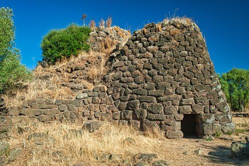 Outside of Sedilo lies an zona archeologica that was developed for tourism years ago and includes several Nuragic structures.
In travel literature, the excavation site is hardly mentioned, even though it is well worth seeing.
The site can be visited freely, though the information boards are unfortunately quite weathered, and no guided tours are offered.
The Nuraghe was constructed in multiple phases and consists of three interconnected towers.
Today, only the eastern tower is accessible, as part of the structure has collapsed. So far, no additional entrances or connecting corridors have been uncovered.
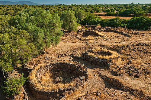 You can climb up to the upper platform of the Nuraghe from the outside.
From there, you have a lovely view of the neighboring round-hut village and Lake Omodeo.
The village surrounding the Nuraghe originally covered an area of 2 hectares. The well-preserved foundations likely belong to both residential and religious buildings.
A short distance away, there is a small structure whose walls still extend beyond the entrance. It resembles a miniature version of a Nuraghe.
How to get there:The Nuraghe is located about 2 km southwest of Sedilo (see map). It is only sparsely signposted in town.
The narrow, paved road transitions into an unpaved track about 150 meters before the parking area, but it is still easily navigable.
 About 100 meters southeast of the Nuraghe lie the remains of two Giants’ Tombs.
At first glance, they may not seem particularly impressive, as they are unfortunately not very well preserved.
However, upon closer inspection and comparison with similar structures in Sardinia, one cannot help but notice the incredible precision with which they were constructed.
While the stone slabs and rock blocks of many Giants’ Tombs were only roughly worked, here all surfaces have been carefully smoothed, and the stones fitted together seamlessly.
 It is worth taking a close look at the preserved walls of both tombs.
In some areas, the stones have been shaped into irregular blocks that fit together like a 3D puzzle.
On some scattered blocks, you can even see grooves and tenons that were finely crafted to prevent the stones from shifting later.
I have not encountered anything like this elsewhere in Sardinia.
The eastern tomb (photo) features a semicircular apse at the end of the gallery, constructed from perfectly hewn, massive blocks. The capstone lies a few meters away.
Since both tombs are situated at the edge of the basalt plateau, you also have a beautiful view from here of the valley and Lake Omodeo.
Necropolis of Ispiluncas
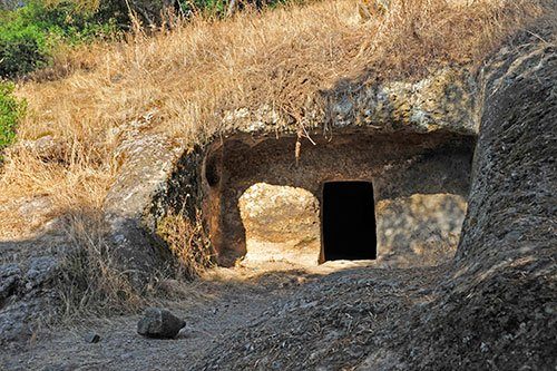 The path to the necropolis is signposted at the zona archeologica and leads down a steep slope to the east.
Here and there, red-and-white markers can still be seen on trees and stones.
After about a 10-minute hike, you will reach a large information board. The two largest rock-cut tombs (domus de janas) are located behind this sign, slightly above the path, and are difficult to spot from below. During my visit, the entrances were partially overgrown.
You may need to scramble around the slope a bit to find them.
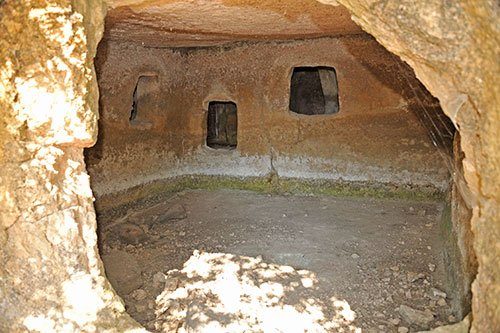 A total of 33 domus de janas have been discovered on this slope, though only two (domus 2 and domus 3) can be entered.
Both tombs consist of several interconnected chambers and were used as burial sites up until the Middle Ages.
In domus 2, the ceiling was designed to resemble a slanted roof with beams.
If you wish to explore the tombs from the inside, be sure to bring a flashlight.
Sturdy shoes are also recommended, as parts of the path are very steep and slippery.
Nuraghe Toscono
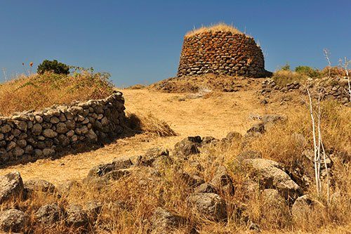 On the plateau north of Sedilo, there are several other Nuraghi and Giants’ Tombs, varying in their state of preservation. Some are located far off the beaten path, so here I will only describe those that are easily accessible by car.
Nuraghe Toscono was built at the beginning of the Iron Age (5th–3rd century BCE) and still stands about 7 meters tall at its highest point.
Due to partial collapse, the original entrance on the southeast side is no longer accessible. However, there is an opening on the west side through which you can slip inside.
The site is freely accessible, but you will need a flashlight to explore the interior.
Archaeological evidence in the vicinity of the Nuraghe indicates the presence of a village, inhabited until the Late Middle Ages, which flourished during the Roman occupation of Sardinia.
Giants’ Tomb Santu Bainzu
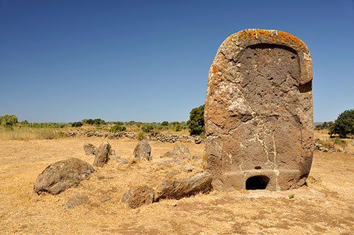 The only surviving feature of the Giants’ Tomb Santu Bainzu is its impressive portal stele.
The stele is over 3 meters tall and 2 meters wide, carved from a single massive stone block.
At its base is the characteristic small opening leading to the former gallery. Above the opening, a small bowl-shaped feature carved from the stone is still visible.
How to get there: The Giants’ Tomb is located about 2.5 km east of Borore. It can be easily spotted from the SP33 Borore-Dualchi road.
Turn off toward the San Gavino church, where you can park your vehicle (see map).
From the small parking area, the stele of the Giants’ Tomb is already visible, just 80 meters to the west.
Giants’ Tomb Imbertighe
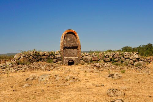 The tomb was discovered in 1908 by the Scottish archaeologist Duncan MacKenzie. It is associated with a Nuraghe located about 100 meters away, though only sparse remains of it survive today.
The impressive entrance stele, carved from a single block of stone, stands 3.65 meters tall.
Unlike most Giants’ Tombs, no additional stone slabs were erected beside the stele. Instead, a wall was built from three rows of stones.
How to get there: Imbertighe is located south of the SP33 near Borore (see map).
From the SP33, take the eastern exit from Borore and follow the Strada di Imbertighe southward.
About 100 meters after passing under the SP33, you will see the site on the right-hand side.
Nuraghe Sa Jua
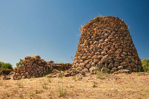 Sa Jua is rarely mentioned in travel literature, despite being quite well-preserved and easy to find.
The Nuraghe is open for free visitation.
The original structure consisted of a main tower and a smaller secondary tower, though the latter has partially collapsed.
The main tower still stands about 11 meters tall and can be climbed from the inside.
From the top, you are rewarded with a stunning view of the nearby village of Aidomaggiore and the valley stretching down to Lake Omodeo.
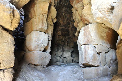 The entrance to the main tower is located in the courtyard between the two towers. As with many Nuraghi, there is a so-called guard cell immediately to the right of the entrance, while to the left, a staircase leads upwards along the outer wall to the platform.
The main room, with its corbelled vault, has a diameter of about 5 meters and features three large niches.
How to get there: The Nuraghe is located on the western edge of Aidomaggiore, above the town near the campo sportivo. The two main roads, SP25 and SP23, pass directly by the site (see map).
