Olbia and surroundings
map of Olbia and surroundings
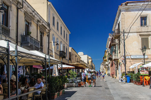
Olbia is mostly known as a seaport and many tourists arrive here by ferry. The town itself is very modern. There are only a few small shopping streets and old houses in the centre. According to this, there are not many sights.
Instead of waiting for hours for the ferry in the port, I suggest to park your vehicle at the archeological museum and then stroll in the street Corso Umberto. There are numerous little restaurants and shops and in summer even some booths.
In the near vicinity there are a few interesting relicts of Sardinian history. Unfortunately, these places are difficult to find. Friendly members of a local cooperative, which oversee a few of these relicts, are very helpful for giving you information.
My recommendation: Visit the well temple “Sa Testa” (which is the only one to be found easily) first and then ask there for information for how to find the other sights.
Archaeological Museum
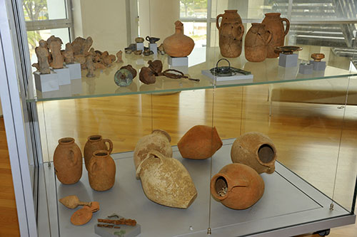
The museum is nearby the port (see map), with a big car park in front of it. This car park is useful if you want to wander through Olbia’s centre.
In this modern building you see mostly finds, which were dug during the construction of the Olbia road tunnel.
The exhibits derive from all periods of the Sardinian history and range from the Stone Age to the Middle Ages. You’ll find exposed pottery, coins, jewels and more. The entry is free.

The most important exhibition is in an air conditioned hall, which is separated from the museum.
It shows remains of Roman ships, which sank near the port, destroyed by the Vandals during the conquest of Sardinia.
There are copies of two ship’s segments at the forefront of the hall, which give a good impression of how big the loading spaces used to be.
Later on more wooden parts were added to the wrecks in order to provide the visitors a better insight into the construction of the ships.
If you want to enter this hall, you’ll have to ask first at the info-point for entering this hall. It ‘s forbidden to take pictures with the flashlight.
Punic town wall
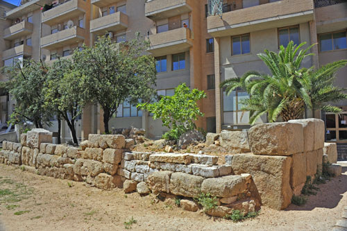
A few scarce remains of the ancient town wall can be found a little distant from the city centre.
The ruins were part of the western part of the Punic wall. To be better armed against machinery of war, this section was built as a double wall, because it ran landward.
The other walls were built in a single construction, because they ran parallel to the coast and it was possible to defend the access to Olbia’s gulf quite easily.
The remaining part of the wall is approx. 60 m long and includes a gate and a square tower.
A cistern was found in the tower during the excavations. The occupation surely used it for the drinking water supply.
The ruins are located between the Via Acquedotto and the Via Torino, among modern apartment buildings. (see map)
San Simplicio
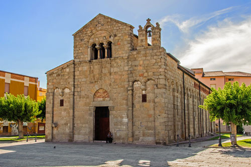
The church is somewhat hidden off Corso Umberto, on the other side of the railway tracks. (see map)
It is a Romanesque basilica built on a hill outside the city walls of that time during the 11th and 12th centuries. A Punic cemetery, a Roman temple and a Byzantine church had previously been located here.
It was named after the oldest known bishop in Sardinia, who was also one of the five martyrs of the island and is the patron saint of the city of Olbia.
The relics of Saint Simplicio were discovered during the construction of the crypt in 1614.
The building material used was mainly granite, and the barrel vaults are made of baked bricks.
Inside, there are two frescos still preserved and milestones of the old Roman road are set up.
The small bell gable was added during the Spanish occupation.
Nekropole San Simplicio
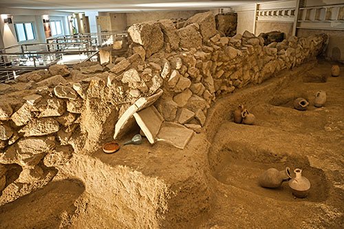
During work in the vicinity of the church, a Roman necropolis from the period 200 BC to 300 AD was first found.
Since there had already been a place of worship here from earlier cultures, that was used until the Middle Ages, further excavations recovered relics from 1700 years of history.
A total of about 450 graves were discovered.
Different types of graves, two wells, ceramics, various grave goods and remains of a Roman temple can be visited.
When you buy your ticket, you’ll receive an audio guide that provides comprehensive information about the site and its history in several languages (including English).
You will find the entrance and ticket sales of the necropolis on the left, behind the entrance of the parking garage under the hill. (see map)
Well-Temple “Sa Testa”
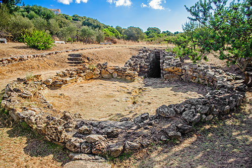
Water has been revered since ancient times on the dry island and important sources were surrounded with temples. Apparently, the Nuraghic people used to practice religious rites around the water.
The site was discovered by shepherds by chance in the 1930s, excavated in 1938 and restored in 1969.
The temple is about 4,000 years old and very well preserved in its entirety.
During a visit one first enters an atrium, followed by a vestibule and, down the steps, the source, which has water even during the summer months.
How to get there: In Olbia, first follow the road towards “Lido Pittulongo” and turn off towards “Porto Industriale” at the periphery. Immediately after a large roundabout, the access road to the well-temple branches off to the left. (see map)
www.donnanuragica.com/siti-archeologici-sardi/pozzi-sacri/terranoa-olbia-pozzo-sacro-sa-testa
Nuraghe “Cabu Abbas” also named “Riu Mulinu”
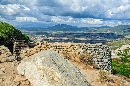
The nuraghe is situated on a hill north of Olbia, overlooking the entire lowland. The complex was built during the Bronze Age around 1,500 BC and was inhabited until about 850 BC.
The whole complex is surrounded by a wall of 5 m height. The nuraghe itself is, compared to some others, surprisingly small.
The numerous funds from there are partially exhibited in the National Museum in Cagliari.
A trip to this place is really worthwhile just because of the magnificent view of Olbia and the surroundings.
The ascent from the car park involves about 10 minutes of scrambling in the rocks.

How to get there:
The nuraghe isn’t visible from the street!
The footpath described in some travel guides from the church “Nostra Signora di Cabu Abbas” is, in my opinion, not recommended. It’s better to ask for information at the ticket selling booth of the well-temple “Sa Testa”. There you might also get a map.
From the well-temple, drive first in the direction of “Sassari” and then turn right into “Via Sa Rughittola” in a small industrial area.
Small brown signposts will then show you the way to the nuraghe.
A gravel road begins here, which is reasonably passable, and later becomes very narrow and steep. Further up, the road is asphalted again. It winds up the mountain and ends at a spring with a tiny car park. From here, we you continue on foot. (see map)
Roman Aqueduct
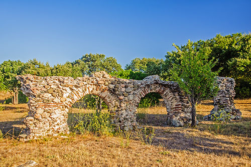
Directly on the outskirts of the city, on the railroads to Golfo Aranci, there are some remains of an above-ground aqueduct. During the Roman occupation this water line brought the water from Cabu Abbas to Olbia, which was 7 km far away.
The water first flowed from the spring in an underground channel and then via the aqueduct.
The ruins are situated in a small park, whose entrance gate is usually open. Unfortunately, many of the arches are destroyed, some are supported by steel girders.
The whole complex dates to the 2nd and 1st centuries BC and is one of the few purely Roman structures still preserved in Sardinia.
The approach is a little bit difficult in the maze of one-way streets in Olbia. If you have a navigation system, let it guide you to Via Mincio, or ask the natives. Follow this street until you’re outside Olbia and you will pass directly the aqueduct. (see map)
Castello di Pedres
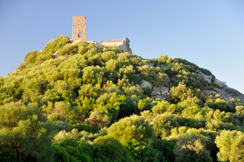
The fortress dates back to the 11th century and is now only in ruins.
From the top the view on the surrounding is great. There are remains of the wall and of the four-sided tower.
How to get there:
Take the road from Olbia to Loiri. Even before passing under the motorway, a narrow road branches off to the right, which later becomes a dusty track. From the turnoff to the fort, it is about 2 km. (see map)
Giants’ tomb Su Monte ‘e S’Ape
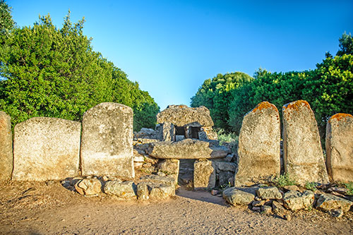
The tomb is located almost directly at the foot of the hill on which you can see Castello di Pedres.
Like the other giants’ tombs in Sardinia, it dates back to the Nuragic culture.
This impressive tomb complex is preserved quite well, although the central stone stele is missing.
Pass the car park at the castle and turn left at the next road junction.
