Posada and surroundings
map of Posada and surroundings with marked sights
Posada
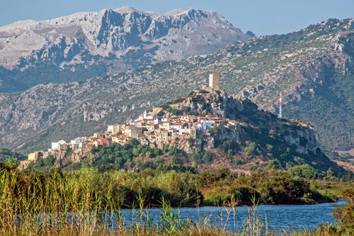
In the middle of the estuary valley of the Fiume di Posada stands a massive rock, on whose slopes the tranquil town of Posada clings. Over everything towers the castle’s turret from the 12th century.
The location of the village alone is unique.
Tourism is largely concentrated on the outskirts of the center – a lot has been invested in holiday apartments and houses here in recent years.
The beach only gets crowded in a few spots.
Since there is a nature reserve right behind the coast, the 10 km long beach can only be accessed at certain points. If you walk a bit away from the parking areas, you will be almost alone.
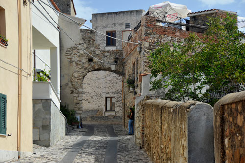 The historic center of Posada stretches up the hill with its narrow cobblestone streets and steep stairs.
It is best to park your car at the bottom of the town, as driving is prohibited further up.
Take your time on the ascent to the castle and enjoy the stroll through the quiet “Centro Storico” with its small souvenir shops, bars, and restaurants.
Along the way, you will also pass the old church of Sant’ Antonio.
Castello della Fava
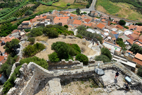
A legend gave the “Castle of the Bean” its name. It is said that around 1300, the Turks besieged Posada, hoping to subdue the town by starvation. The clever inhabitants came up with a ruse. They fed a handful of beans, which were left, to an injured pigeon and let it fly towards the besiegers. The pigeon fell, and the Turks opened its full stomach. Now they believed the besieged had enough food and withdrew.
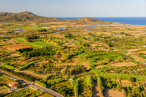
From the castle, you can enjoy a wide view of the surrounding coastal plain and the nature park at the mouth of the Fiume di Posada.
Since the river’s water is dammed further inland at Lago di Posada, the water volume can be regulated despite seasonal fluctuations, benefiting the agriculture that is actively practiced here.
Lago di Posada
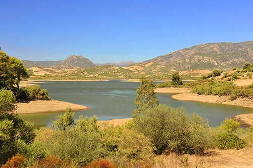
The reservoir is about 8 km inland. It is also known by the names Lago di Torpè and Lago Maccheronis. Therefore, different names are used on maps and signposts.
The location of the lake is quite beautiful, and the water is very clean.
In spring, the lake invites you to swim – it is often warmer than the sea at this time. In summer, the water level drops significantly.
Until a few years ago, a road led over the dam, which is still marked on many maps. Since the dam was raised, this passage is no longer possible.
Stagno Longu
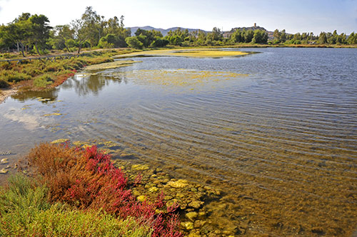 The lagoon lake lies just behind the beach between Posada and the holiday village of San Giovanni.
A narrow road branches off at the Posada sports field, with a sign “Percorso Naturalistico.”
The lake is fed by the Rio Santa Caterina, which has created a vast lagoon landscape in the plain here.
Few tourists venture here; you might only encounter a Sardinian fishing or on their way to their garden.
The shore is wonderfully quiet. Especially in the late afternoon, you can take nice walks and, with some luck, observe numerous water birds.
Monte Longu
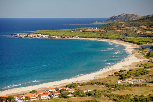
This 174 m high mountain is one of the most beautiful viewpoints on the northern east coast and is very little known. I was always alone up here.
From the top, you can overlook the entire floodplain of the Fiume di Posada with its nature park and the beach in front of it. To the south, the view stretches along the beach of La Caletta to Capo Comino and far inland.
The summit is actually only accessible on foot. There is a track leading up, but it is not suitable for regular cars.
The ascent takes about 40 minutes.
Wear long pants and sturdy shoes. Then you can take photos off the path as well.
How to get there: When driving from Posada to La Caletta, a road branches off to the left to the holiday village of San Giovanni. A few meters before this turn-off, the path to the mountain begins on the right. It is best to park in San Giovanni. (see map)
