Siniscola and Surroundings
map of Siniscola and Surroundings
Siniscola

The small town is the bustling center of the region and offers all essential services.
Especially during the weekday mornings, the main streets are completely crowded.
Tourism is hardly noticeable here, as the Sardinians mostly have the town to themselves.
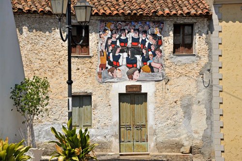
The historic center around the San Giovanni church is a colorful mix of some modern buildings and many beautifully restored historic houses.
If you come here by car, it’s best to park outside the center and continue on foot. (see map) Away from the main streets, the alleys become so narrow that it’s impossible to pass through with a car.
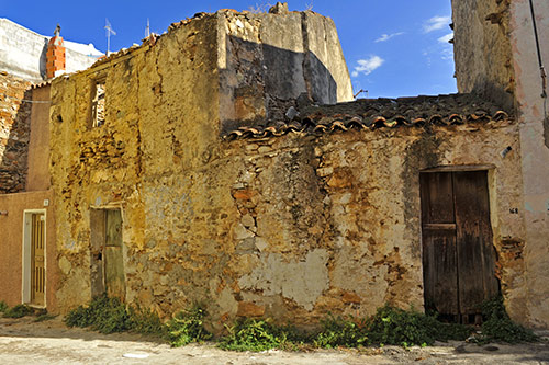
Strolling through the narrow and shady alleys of the centro storico, you will notice many typical historical buildings among the new or restored houses, which have shaped the townscape for centuries.
These often tiny buildings have been uninhabited for decades and will likely gradually disappear from the townscape.
Archaeological finds indicate that the area was inhabited as early as the Nuragic era due to its advantageous geographical location. The first major settlement likely dates back to the Etruscans before Sardinia was conquered by the Carthaginians.
Under the Carthaginians, Olbia and Feronia became the most important ports on the east coast. Feronia has not yet been definitively located but was likely in the area of today’s Posada.
The Romans later made Siniscola a military base. After Feronia was destroyed by the Vandals, its inhabitants sought refuge inland, making Siniscola the most important town in the area.
The origin of the place name Siniscola, Sardinian Thiniscole, is not entirely clear. It is likely that it originated in the Middle Ages from the Latin “finis scholae,” because at that time, the town lay at the southern border of the jurisdiction of Gallura. Another hypothesis mentions a visit by Bishop Bonifacius from Senafer, who came here in 484 for a synod. Based on this, some historians suggest that the name Siniscola derives from Senafer.
The first documented mention dates back to 1263 when the Archbishop of Pisa arrived at the port of Santa Lucia. In 1514, Saracen pirates attacked the coastal area during the period of Spanish rule, leading to the construction of the watchtowers of Santa Lucia and San Giovanni (see map), which are still standing today, as well as some defensive walls.
In the 17th and 18th centuries, maritime trade increased significantly. Siniscola had two ports, one in Santa Lucia and one in Predas-Niedda (today La Caletta), which further boosted the town’s importance.
Wash Place “Sa Untana”
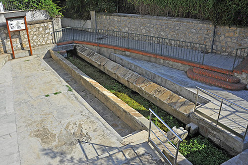
A bit below the busy Via Olbia, there is still an old wash place, which was typical for most Sardinian towns. (see map)
The original facility was built in 1870. Water was drawn from the Gana ‘e Gortoe grotto, supplied the fountain for drinking and washing water, and filled the cattle trough that was also here.
Women had to carry all the water needed at home in large jugs.
In 1911, “Sa Untana” was demolished for hygiene reasons.
However, due to strong demand from the population, the fountain was soon rebuilt—this time without a cattle trough.
In 1932, a canal was built to channel water from the grotto through the fountain to the Rio Siniscola, where it was also used for irrigating fields.
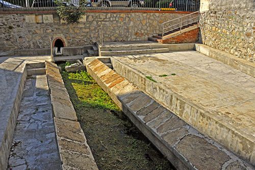
In 1935, additional fountains were built in Siniscola to facilitate water supply for the population. Sa Untana lost some of its significance but remained the only public place for washing clothes.
A new cattle trough was built next to the fountain, soon becoming a meeting point for cattle traders who met here on their way to the market to negotiate prices.
In the 1950s, the trough disappeared and was replaced by Siniscola’s first gas station, which no longer exists.
Sa Untana played a significant social role in daily life and was an important place of communication for the population.
During funerals, it was customary for the priest to give the final blessing here before returning to the church.
A legend tells of the “Sas Panas,” the souls of women who died in childbirth. For a month, these souls came to the fountain at midnight to wash their bloody clothes. Thus, for a month after such a sad event, no laundry was beaten on the stones; otherwise, the souls of these women would never find peace.
Spiaggia dei Confetti
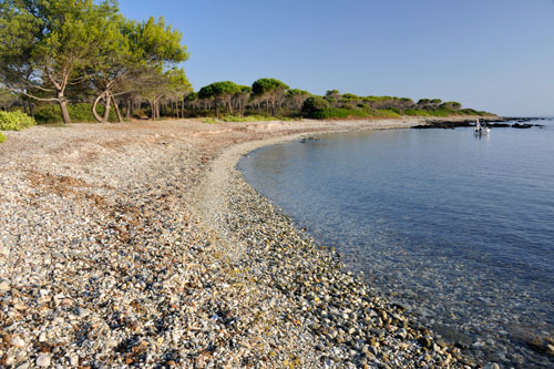 South of Santa Lucia, the fine sandy beach ends and the coast becomes rocky. Here, the tourist hustle and bustle significantly decreases.
About 500 meters from the southern edge of the town lies the little-known “Spiaggia dei Confetti” (Confection Beach).
In several small, serene coves, small, round stones in various colors have been washed ashore, creating a charming beach.
The coves are less suitable for swimming due to the underwater rocks, but you can take wonderful and usually very quiet walks here.
A path runs directly along the beach towards Capo Comino, and just behind it stretches an extensive pine forest with several picnic tables in the shade.
Wild campers often set up tents here.
From Siniscola to Sant’ Anna
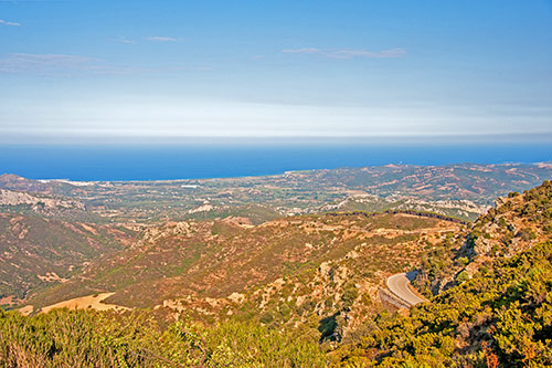 From Siniscola, a road winds up the slopes of Monte Albo via wild serpentines.
The drive to Sant’ Anna offers beautiful views of the coastal plain. (photo)
Although the sea is always in sight, the temperatures up here are often pleasantly cool, even in the height of summer.
Along the road, there are several access points to springs and hiking trails on the mountain slopes. If you are traveling by a regular car, it is best to leave your vehicle at the beginning and continue on foot along the unpaved paths.
At the top near Sant’ Anna, the road continues straight down to Lodé and left towards Lula. Both routes are scenically beautiful and, due to their curves, particularly popular with motorcyclists.
From Monte Albo to Lula
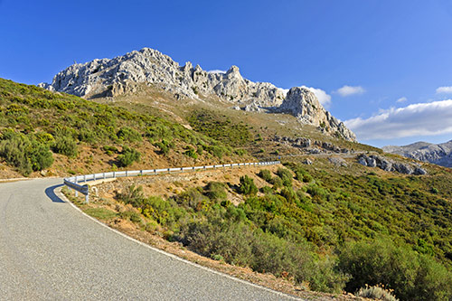 The road to Lula runs along the northern slopes of Monte Albo, about 25 km to the southwest. There is very little traffic here. However, cautious driving is necessary because goats and sheep often wander onto the road in this remote area.
Shortly after Sant’ Anna, the limestone massifs of Monte Albo resemble the peaks of the Alps. There are several parking spots if you want to hike here. Although Monte Albo appears insurmountable from the SS 131, the elevation differences are not as great up here.
From the peaks, you have a fantastic view of the coast, reaching far north to Isola Tavolara and, on clear days, even to Corsica.
The further you drive towards Lula, the greener the mountain slopes become. The road passes through partly dense forests.
Janna ‘e Pruna and Su Notante
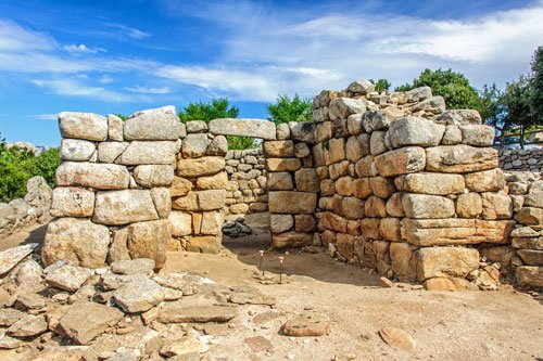
These two archaeological sites are still a real insider tip as they are rarely mentioned in German travel literature.
The Temple of Janna’e Pruna stands on a pass at Monte Senes. An important connecting route between the valleys of Cedrino and Riu Siniscola ran through here as early as the Bronze Age.
The view from here into the two neighboring valleys and over to Monte Albo is magnificent.
How to get there: From Capo Comino or Irgoli, there are two well-marked routes. From the SP72, two continuously marked access roads branch off at about km 1 and 5 (brown signs).
Both routes are very narrow but easy to drive and are 11 km and 8 km long, respectively.
From the other side, coming from Nuoro, Olbia, or Siniscola, there are (so far) no signs.
From the expressway SS131dcn, take the southern exit “Siniscola, Orosei” and turn right into the SP45 immediately after the exit. Follow this for about 6 km and then turn left onto a narrow road (this turn is marked with “G” on the map). The road is paved all the way and winds 7 km up the mountain. At the junction at the top, turn left and after 100 m the temple is on the right side.
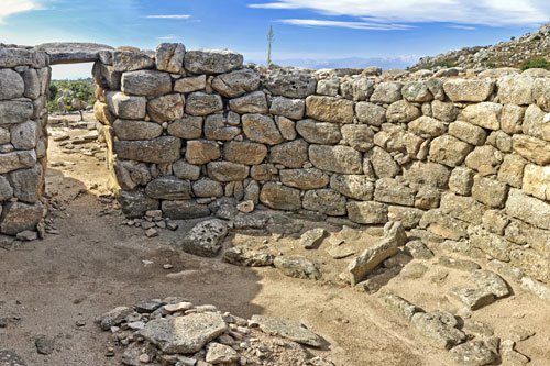
The sanctuary was built by the Nuraghians towards the end of the Bronze Age. It consists of two rooms – a small rectangular antechamber and a round main room, which also contained a hearth. The thickness of the layers excavated at this hearth suggests use for at least 200 years.
For construction, granite blocks from the nearby area were used, roughly shaped, and stacked without mortar. The roof was probably a tholos vault.
The forecourt is surrounded by an elliptical wall, and another rectangular wall ran around the entire temple. Both are still clearly visible.
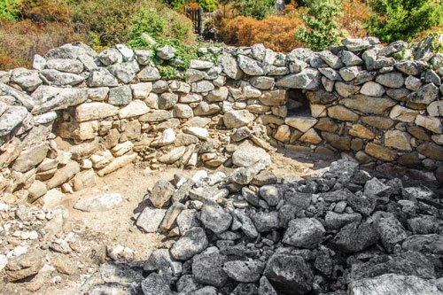 During the excavations, the remains of two other neighboring buildings were found, whose purpose is still unclear. The floors are each paved with large stone slabs.
Unfortunately, illegal looting has destroyed parts of one building. As a result, the area is now fenced and no longer freely accessible. Guided tours are offered in Italian and English.
The finds uncovered during the excavations are on display at the museum in Irgoli. Admission includes a visit to this museum.
An “area didattica” has been set up behind the temple.
In reconstructed nuraghic round huts, students of the 4th and 5th grades are introduced to archaeology and Sardinian history. For example, copies of artifacts are hidden and then discovered and excavated by the enthusiastic students.
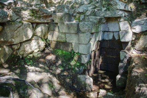 About 250 m below the temple are the remains of the nuraghic sacred well “Su Notante”.
The well stands on a slope in the shady valley of Riu Remulis, which has its source here.
Unfortunately, in the 1920s, large parts of the sanctuary were destroyed in the search for water (and the subsequent encasing of a spring with concrete). Systematic excavations did not take place until 1994. The concrete casing is still there.
The small well is very similar to the well temple Su Tempiesu. Precisely worked blocks of basalt were used for the construction here at Su Notante as well. This stone is not found in the area and was specially transported here from the Orosei area.
The effort involved suggests a great significance of the sacred well and the neighboring temple.
